BannerImages
Go directly to the Comments section
Hello and welcome to our banner images gallery which is a store of all the scrolling banner images that have appeared on the site since it started on 02/04/2011.
Some of the images are linked to articles or to other sources on information.
If you would like to add one of YOUR images to the scrolling banner and also to this banner images page then please click here
When you are on the Home page the banner scrolls continuously through a selection of up to 5 of the images you can see below:
- If you come back to Home while the banner is scrolling the scroll will restart from the beginning
- And if you click on any of the scrolling images when on the Home page you will be taken directly to its location on this banner page
 This is the latest image in our scrolling banner gallery - scroll DOWN for more banners and UP for more information about the gallery.
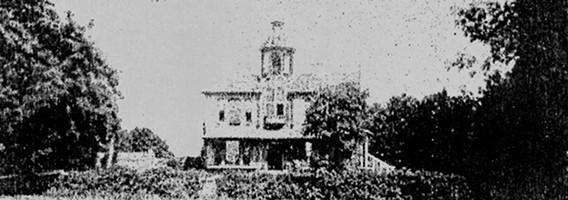
pic48 ... Apton Hall, with its cupola
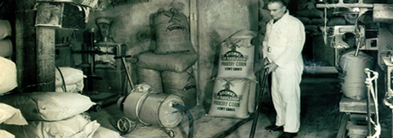
pic47 ... Rayleigh Mill, Mr Ambrose W Prior. Photo taken Sept 1950
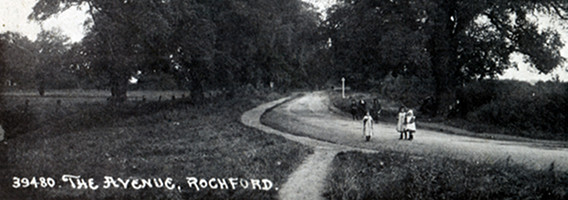
pic46 ... Hall Road, Rochford
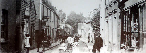
pic45 ... West Street, Rochford
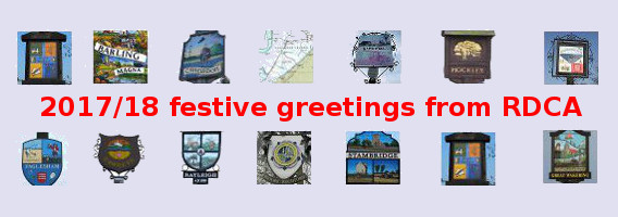
pic44 ... Seasonal Greetings 2017/18
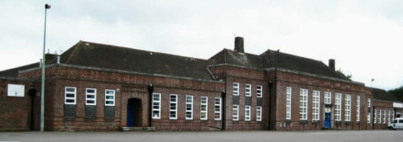
pic43 ... Rocheway School - current boarded-up state. Click here for site article.
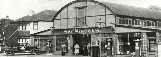
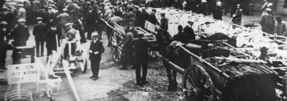
pic42 ... Pre-war view of Whittingham's Rochford Garage just before hostilities began in 1939. Published in the Echo of 08.05.1995
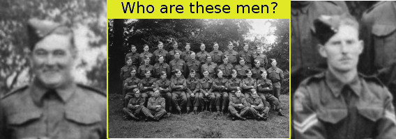
pic41 ... Home Guard 1939-45, Barling, Wakering, Sutton and Shopland. Click here for site article.
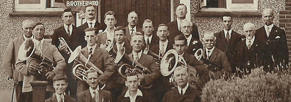
pic40 ... Brass band Rayleigh British Legion. Click here for site article.
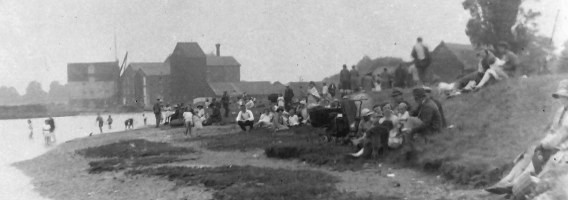
pic39 ... Stambridge Mills ca. 1920 in the background. At this time the area on the Roach estuary was very popular for bathing, being the nearest "seaside" resort to Rochford. Glass plate photograph taken by Samuel Saxby-Hill, a local professional photographer. Samuel was a well known figure in the District and many of his pictures were made into postcards. He also had a framing shop in the parade near the Anne Boleyn pub where he sold paintings and copies of his photographs.
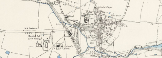
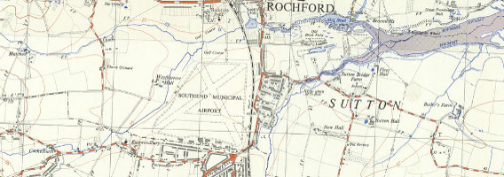
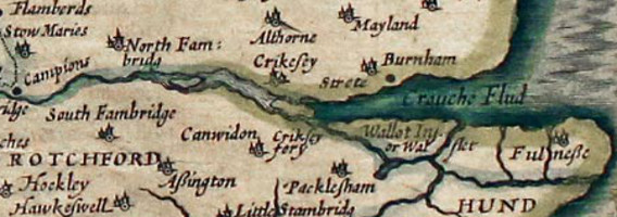
pic38 ... Extract from an 1898 OS Six Inch series map of Essex showing Rochford and its immediate surroundings - see text under next image for more information.
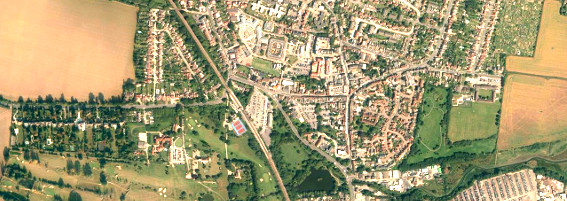
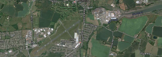
pic37 ... This is a modern satellite image of exactly the same area as in the above 1898 OS map. Click here and you will be taken to the NLS source page. Look down the left hand side of the NLS page. Near the bottom you will see "Change transparency of overlay:". There is a blue button just under this. Move the blue button from right to left to progressively change from the 1898 map image of Rochford to the modern satellite image. Some things have altered a lot and others not at all. If you want you can move to your area in the district and do the same. Use the magnify/demagnify in combination with dragging the map to get to where you want and at the scale you want. Once there you can change the underlying maps by picking from the drop-down selection offered in "Select a map / map series". Good luck!
pic36 ... Photo from Patricia James. Click here for more information (her comment of 16/03/15).
pic35 ... Map of part of the Rochford District including airport (OS 1:25000 1937-61), courtesy of National Library of Scotland (NLS).
pic34 ... Satellite image of exactly the same part of the Rochford District as above. Click the following link to an NLS image of Eastwoodbury and its replacements. Use the horizontal slider that appears in the bottom left corner of the NLS map to see Eastwoodbury disappear and the Tesco roundabout and airport runway appear (2014 Google satellite map).
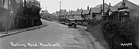
pic33 ... Rectory Road, Hawkwell. Looking towards the church with the terrace properties opposite Sweyne Avenue. The card was posted in Hockley in November 1905 by a Mrs Hughes to her daughter in Leyton. See also this article from Val Smerdon.
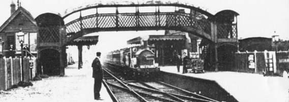
pic32 ... Hockley railway station, winter 1908.
pic31 ... Magnified image of the Crouch estuary from John Speed's map of 1610. Click here to see the article on the crossing based on Philip Benton's book and comment from B Meldon on the crossing and the history of the several little islands in the estuary.
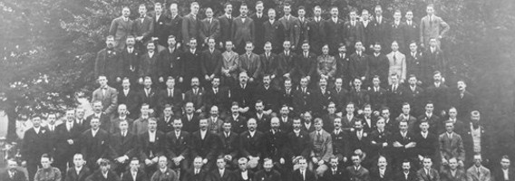
pic30 ... Group image of Rayleigh men who returned from WW1. Click here for further information.
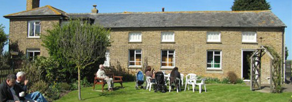
pic29 ... Foulness Heritage Centre. The centre is open on the first Sunday of each month during the summer. Click here for further information.
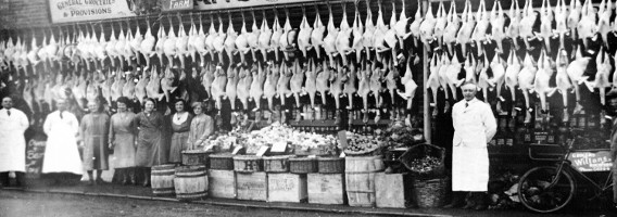
pic28 ... Willans butcher shops. Photo taken sometime in late 19th or early 20th Century, around some Xmas time one presumes. (courtesy
Peter Thorogood)
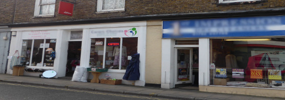
pic27 ... South side of Rochford Square taken in 2014 - the site of the Willans butcher shops shown in pic28.
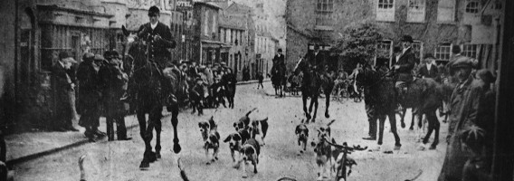
pic26 ... Huntsmen and hounds leaving Rochford Square, date unknown (courtesy Peter Thorogood).
Editor Note. The original photo has the typescript caption "ESSEX UNION HUNT AT ROCHFORD: Leaving the Market Square". Terry Ive has spotted that the photo is the wrong way around - its now corrected so the photo doesn't look funny anymore but the caption on the corrected original is now, of course, back to front!
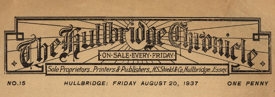
pic25 ... Banner header from the old Hullbridge newspaper "Hullbridge Chronicle" (courtesy Gary Congram).
pic24 ... Detail from a Rochford Square market scene - photo taken during 1920s (from Peter Thorogood's collection).
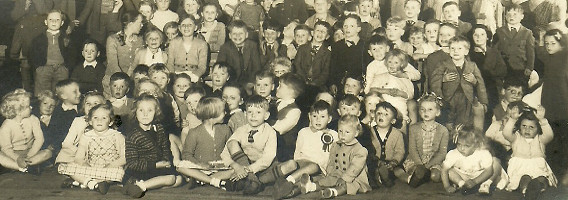
pic23 ... 1953 Street Party for Coronation. Click here to view the article by Viv Irvine.
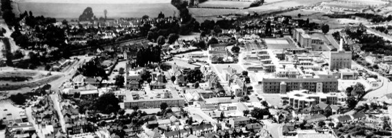
pic22 ... Rochford Hospital site before demolition. Date aerial photo taken unknown but must have been taken, at latest, during late 1980s.
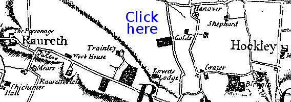
pic21 ... This is an extract from the 1777 Chapman and André Essex map, showing part of the western end of the RDCA district. The above Click Here link on the map takes you no further. However, there are many internet sources of old maps of our area. This part of the site ancestry.com is one of them.
You will find lots of other sources by Googling Old Essex Maps: the site british-history.ac.uk is a useful starting point that is relatively non-commercial.
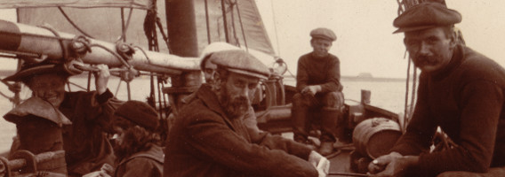
pic20 ... An early 20th Century day out on a sailing boat. Paglesham maybe?
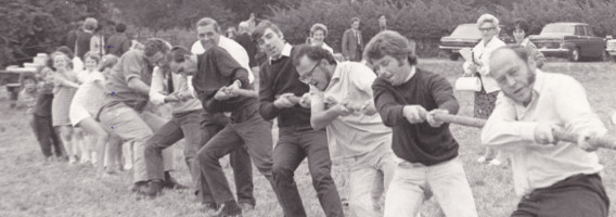
pic19 ... Tug of War at the 1971 Paglesham Village Produce Association (VPA) Fair. Anyone care to put names to faces?
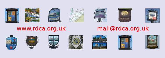
pic18 ... Composite image of all the 14 Parish signs of the Rochford District (Foulness has been given a symbolic image as it has no Parish sign).
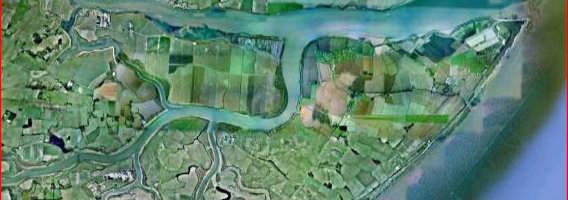
pic17 ... Google Earth satellite image of the rivers and islands of the District. Image probably taken around 2007, prior to the commencement of RSPB wetlands work on Wallasea Island. The image shows the predominantly rural nature of the eastern end of the RDCA area.
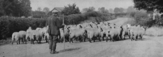
pic16 ... Mr Quy herding sheep ... date unknown.
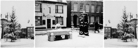
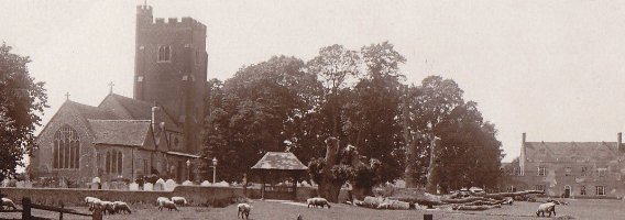
pic15 ... The Rochford Square in Winter ... date unknown.
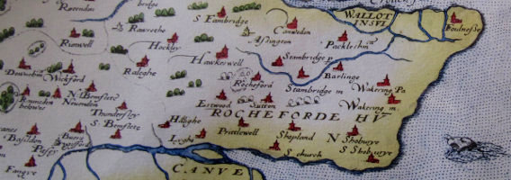
pic14 ... The Rochford Hundred, an extract from an Essex map of 1576.
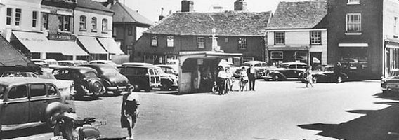
pic13 ... Rochford Square, date of photo unknown but probably taken in the 1950s. The buildings in the background were demolished after a fire and replaced by the current block of shops and offices.
pic12 ... St. Mary's Church, Churchend, Foulness Island. The photo was taken in April 2012. The interior is now unsafe and the church is surrounded by barriers.
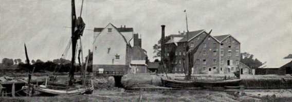
pic11 ... Stambridge Mills, date unknown.
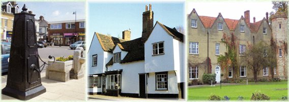
pic10 ... Rochford Pump; Old House Rochford; Rochford Hall.
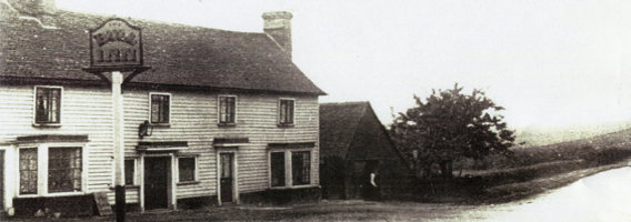
pic9 ... Bull Inn Hockley, then on the edge of town!
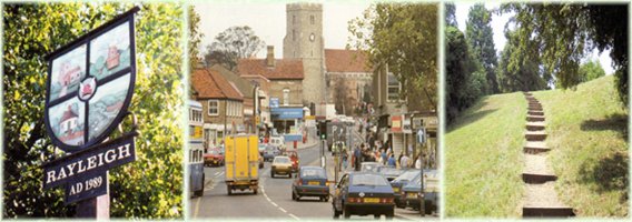
pic8 ... Rayleigh Parish Sign; Rayleigh High Street; Rayleigh Mount.
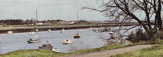
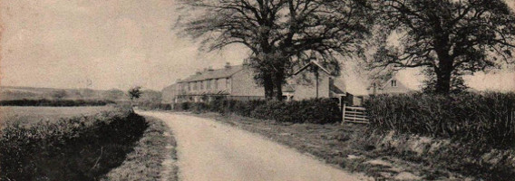
pic7 ... Hullbridge River Front, circa 1960.
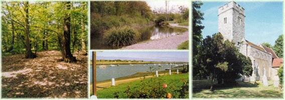
pic6 ... Hockley Woods; Cherry Orchard Country Park (top); Hullbridge River Front (bottom); Holy Trinity Church, Rayleigh.
pic5 ... Rochford Square, circa 1910.
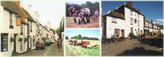
pic4 ... High Street, Canewdon; Farming; Churchend, Paglesham.
pic3 ... St. Andrew's Church, Rochford, circa 1920.
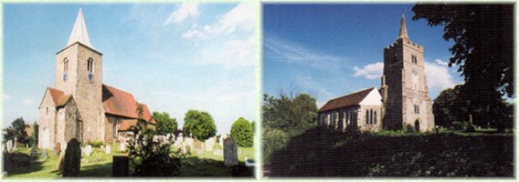
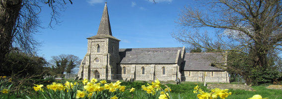
pic2 ... Great Wakering Church; Barling Church.

pic1 ... This was a default image we used for for iPads and all other non-Flash browsers before the site moved to HTML5.